
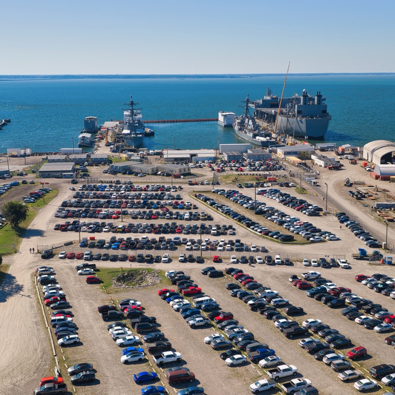
A construction loan doesn’t pay out on promises. It pays out on proof — and drone construction progress photos are fast becoming the standard way to provide it. Every draw request answers the same question: is the work that’s been billed actually in place?
That’s the job aerial progress photos do. Not the pretty shot for the brochure — the dated, consistent, whole-site record that shows a lender, an owner, and a GC the same thing: what’s done, what’s in progress, and what’s next.
The draw problem
On a big build, the people deciding whether money moves are rarely the people standing on the site. A lender’s reviewer, an owner’s rep, a project executive — they see paperwork, schedules, and a handful of ground-level photos. Ground photos are honest, but they’re narrow: a wall, a corner, a crane. They don’t show the whole site at once, and they don’t show context — where materials are staged, how access is running, what’s happening on the far side of the building.
An aerial photo shows all of it in one frame. That’s what makes drone construction progress photos useful as proof: one image, the full site, dated.
What drone construction progress photos show that a ground photo can’t
The whole site, in context. Roof and envelope progress, site work, staging areas, access roads — all in a single dated frame, so a reviewer can see the job as it actually stands. When the roof and facade are part of the draw, that same flight can double as a drone inspection of the work in place.
Sequencing. Fly the same angles on a regular schedule and the photos become a timeline: foundations, steel, envelope, finishes. Anyone reviewing a draw can look back and see the work accumulate, flight by flight.
Conditions a ground walk misses. Standing water, stockpile levels, equipment placement, the state of the laydown yard — the things that affect schedule and cost but never make it into a close-up.
A record that protects everyone. When the photos are consistent — same angles, same altitude, same schedule — they become a factual record of the build. If a question ever comes up about when something was done, the record answers it.
How often to fly a construction site
It depends on how fast the site is moving. On an active build, weekly flights catch the changes that matter — a week of steel, a roof going on, a phase turning over. On slower phases, monthly can be enough. The point is regularity: a flight plan that repeats the same coverage each time, so every photo is comparable to the last one. A random set of pretty aerials doesn’t prove anything. A consistent series does.
What to ask your drone pilot
Before the next draw, ask these four things:
- Are you Part 107 licensed and insured? This is the floor. If the answer is anything but a clear yes, stop there.
- Will you fly the same plan every time? Consistent angles and altitudes are what turn photos into a record.
- What do I get after each flight? Photos, video, or both — and in what format. Know the deliverables before the flight, not after.
- Can you fly where my site is? Some sites sit under controlled airspace, near airports, or inside facilities with their own access rules. A pilot who handles permits and access is a pilot who doesn’t cost you a missed flight. That includes shipyards and secured facilities — the kind of access our TWIC and MARMC credentials open up.
Proof, not promises
Lenders, owners, and GCs don’t need more photos. They need the right photos — dated, consistent, and complete enough to answer the one question that matters: is the work in place?
That’s what Lyfted Media’s construction progress documentation is built to do. We fly regular progress coverage for developers and contractors across Virginia Beach, Norfolk, Chesapeake, Hampton, Newport News, Portsmouth, and New York City — and nationwide, with clients covering travel. For developers planning what’s next, the same aerial data feeds our view studies and future views.
One example: we’ve documented the port improvements and construction growth at River Port in Newport News for East Coast Repair and Fabrication, as part of a $180 million ship repair and maritime manufacturing investment bringing 414 new jobs to the site. Read the case study — and see all our case studies.
Frequently asked questions
How often should drone progress photos be taken?
On an active build, weekly. On slower phases, monthly can be enough. The key is a regular schedule with the same coverage each flight, so the photos form a comparable record over time.
Do lenders accept drone photos for draw requests?
Aerial progress photos are widely used as supporting documentation for draws, because they show the whole site and its context in a single dated frame. Confirm with your lender what format and coverage they want — then make sure your pilot delivers exactly that.
What should a drone progress photo package include?
Dated aerial photos of the full site from consistent angles, plus video when the draw or the owner wants more than stills. The package should repeat the same flight plan each time, so every round is comparable to the last.